

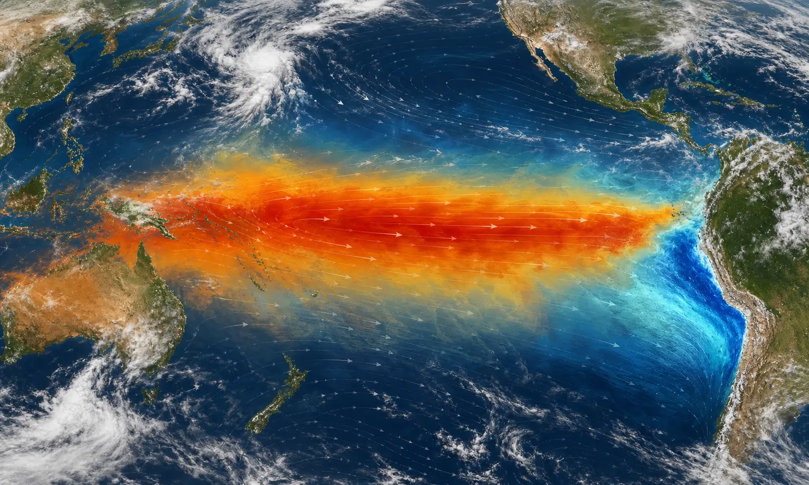

El Niño is often described as a Pacific Ocean event, but that can make it sound smaller than it is. In practice, it is part of a wider ocean-atmosphere pattern that can influence rainfall, drought, storms and global temperatures far from the coasts where it was first noticed.
Forecasts for 2026 should be read as probabilities rather than promises. The source material describes a possible shift from neutral ENSO conditions toward El Niño during the year, with some discussion of a potentially strong event later on. That kind of outlook matters because even a few tenths of a degree added to global average temperature can change the background conditions in which regional weather unfolds.
What El Niño Is
El Niño is the warm phase of the El Niño-Southern Oscillation, usually shortened to ENSO. Meteorologists commonly discuss ENSO in three broad states: El Niño, La Niña and neutral. El Niño is associated with warmer-than-usual waters in parts of the tropical Pacific, while La Niña is associated with cooler-than-usual waters. Neutral conditions sit between those two phases.
The name El Niño comes from Spanish and is traditionally linked to the timing of warm waters that appeared near the west coast of South America around Christmas. Historical accounts often connect the term with Peruvian fishermen, who noticed that the arrival of warmer water could disrupt the anchoveta fisheries that depended on colder, nutrient-rich upwelling.
Those coastal waters are normally cooled by the Humboldt Current and by the rise of deeper cold water along parts of the South American coast. That is why Pacific coastal cities in Chile and Peru can have much cooler nearby seas than Atlantic cities at similar latitudes. The contrast is not just a geographic curiosity. It helps explain why a change in Pacific sea temperature can quickly become an economic and ecological issue.
Why the Atmosphere Matters Too
El Niño is not only about warm water. The atmosphere is part of the same system.
In the early 20th century, the British scientist Gilbert Walker studied pressure patterns across the tropics and identified a long-distance relationship between the South Pacific and the region around northern Australia and Indonesia. When pressure was higher in one part of that system, it tended to be lower in the other. This pattern became known as the Southern Oscillation.
Later work by Jacob Bjerknes connected the ocean warming near South America with these atmospheric pressure shifts. That connection is why the full name is El Niño-Southern Oscillation. It also explains why a change in the tropical Pacific can be linked with weather outcomes thousands of miles away.
When the usual trade-wind pattern weakens, warm surface water can spread eastward across the equatorial Pacific. That shift changes where heat and moisture are concentrated, which in turn can alter rainfall and pressure patterns. The details vary from one event to another, so El Niño is not a simple weather switch. It is better understood as a major nudge to the climate system.
How Strong Events Have Played Out Before
Past strong El Niño events are a useful warning, though they are not a script for the next one.
The 1982-83 event is widely remembered as one of the most intense El Niño episodes of the 20th century. It was linked with damaging weather in several regions, including flooding along parts of the Pacific side of the Americas and drought in areas such as Indonesia and northeastern Brazil.
The 1997-98 event also drew major attention, in part because of severe flooding in California and other highly visible impacts. More recently, the 2015-16 El Niño was among the strongest on record and was associated with unusual global warmth.
These examples show why scientists and governments watch ENSO closely. A strong El Niño can raise the odds of certain regional patterns, but it does not guarantee the same outcome everywhere each time.
Where Impacts May Be Felt
If a strong El Niño develops, the most likely effects would be uneven. Some regions tend to face heavier rain, while others face higher drought risk. The source material points to possible heavy rainfall in parts of Peru, Ecuador, Chile, East Africa, the southern United States and the area around Mar del Plata in Argentina. It also points to possible drought stress in Southeast Asia, parts of Australia and northeastern Brazil.
Those regional signals should be treated as risk patterns, not fixed forecasts. Local weather is shaped by many overlapping factors, including seasonal timing, ocean temperatures outside the Pacific, land conditions and shorter-term atmospheric circulation.
| ENSO state | Typical broad pattern | Important caveat |
|---|---|---|
| El Niño | Warmer tropical Pacific waters can shift rainfall and raise global temperature risk. | Impacts vary by region and by event. |
| La Niña | Cooler tropical Pacific waters can favor a different set of rainfall and drought patterns. | It is not simply the opposite weather outcome everywhere. |
| Neutral | No clear El Niño or La Niña phase dominates. | Other climate drivers can still produce extremes. |
Why a Strong El Niño Can Raise Global Heat
El Niño can add warmth to the global average because heat stored in the tropical Pacific is released into the atmosphere. In a world already warmed by long-term climate change, that temporary boost can push global temperatures higher than they otherwise would have been.
That does not mean El Niño alone explains modern heat records. It acts on top of the broader warming trend. A strong event can make an already warm year hotter, or help set the stage for unusual warmth in the following year, depending on timing and persistence.
The Bottom Line
The main point is not that every place should expect extreme weather from a possible strong El Niño. The point is that ENSO is one of the clearest examples of how connected the climate system is.
A shift in the tropical Pacific can affect fisheries near South America, rainfall in normally dry regions, drought risk in parts of the tropics, and temperature patterns across much of the planet. That is why talk of a strong El Niño deserves attention, but also caution. The responsible reading is probabilistic: the risks rise in familiar directions, but the final outcome depends on how the event develops and how it interacts with the rest of the climate system.